Creotech Instruments S.A., a leading Polish manufacturer of satellite systems and components, teamed up with Droneradar and the Wroclaw Institute of Spatial Information and Artificial Intelligence (WIZIPISI) to launch Geomatic Remote Eye (GREy), a new service for the UAV market. The GREy platform equips drone operators with the required data, automatically carrying out a pre-flight risk analysIs, an indispensable element of every mission.
According to the data of the Polish Air Navigation Services Agency (PANSA), the market for UAV-based based services is booming. While in 2019 there were over 30 thousand UAV flights registered in Poland, in 2021 this number skyrocketed to over 550,000. Some of this traffic is recreational, but considering the number of complex flight plans, the share of flights involving professional services (e.g. inspections, mapping, pollution measurements or supervision) in total operations is consistently rising. Yet the actual revolution is still to come with drone-based parcel delivery and even human passenger drones on the horizon.
“My conversations with business owners indicate that, at present, the greatest hurdle to the further development of the UAV service sector is no longer the technology underlying the aircraft, but rather the infrastructure and legal framework for performing flights, a source of ever more restrictive procedural requirements. That is why we decided to make this element of the UAV ecosystem the focal point of our services,” says Grzegorz Brona, PhD, President of the Management Board of Creotech Instruments S.A.
On the one hand, the surge in UAV traffic has obvious benefits, but it is also a source of hitherto unkown risks to property, as well as health and life. In anticipation of this, the European Commission introduced a number of regulations imposing new obligations on both national aviation administrations and UAV operators. Since this is still a fledgling market, their practical implementation poses several issues for authorities and UAV operators alike. Consequently, this holds back the development of the services market and leads to attempts to bypass the law, with potentially fatal consequences.
To address these challenges, Creotech Instruments S.A. and its partners, Droneradar and WIZIPISI, developed and marketed the GREy platform, which facilitates mission risk analysis by providing easy-to-use tools leveraging an extensive repository of spatial and aeronautical data. The platform is designed to greatly simplify the preparation of documentation for mission planning by UAV operators and subsequent inspection by aviation authorities.
According to Paweł Korzec, the President of Droneradar and a UAV pilot:
“The time required to analyze data before an unmanned flight is often longer than for a manned flight. Because data sources are fragmented and non-uniform, flight risk assessment is frequently much more labor-intensive than the actual missions.”
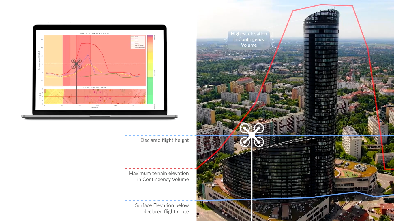
The GREy platform facilitates the visualization and analysis of topography and terrain profile data, i.e. obstacles such as masts, chimneys, windmills, power lines, high-risk areas, population density distribution and airspace information. By collecting information in one, regularly updated repository, the user can submit the planned flight route and receive a comprehensive report compliant with the SORA methodology in mere minutes. The information provided by the platform allows operators to familiarize themselves with potential risks without the hassle of having to acquire and integrate source data or perform time-consuming calculations.
The generated report allows UAV pilots to:
- familiarize themselves with the mission terrain;
- automatically analyze calculated risk ratios for the assumed flight parameters;
- document the above steps for the purposes of the flight permitting process;
all from the comfort of their office.
The archived report will also attest that due diligence was exercised at the mission preparation stage in the event of an incident or accident.
“I hope that our and our partners’ over three-year efforts, supported by the European Space Agency, will allow us to develop this necessary element of unmanned flight infrastructure that is a permanent fixture of its ecosystem, thus reducing the costs and improving the safety of UAV operations,” adds Tomasz Berezowski, Vice President of WIZIPISI.
Initially, the platform will be available to institutional clients, but it will also be accessible to individual UAV pilots in the near future. GREy will be offered under a subscription-based model with the fee depending on the expected monthly number of reports. Its cost has been set to represent a small fraction of the cost of operations.
The platform’s operators have planned a series of free webinars to demonstrate GREy’s capabilities and advantages. The first webinar will be held on 24 February. Registration is available at: https://bit.ly/3HrAmO6.

 Subscribe to receive latest news: