Creotech Instruments S.A., a leading Polish company listed on the WSE’s NewConnect market, and a manufacturer and provider of space technologies to the global market, published satellite photos from 26 February demonstrating the effects of the Russian army’s assault on two Ukrainian airports. Creotech manages one of five repositories of the European Union’s satellite data collection platform under the Copernicus program.
The first set of photos shows the effect of heavy fighting at and around the Hostomel airport. Taken in both visible and infrared light, the images show smoke over the battlefield as well as spreading fire. The Hostomel airport was under attack from the first day of fighting when the Russian army landed troops on it using 20-30 helicopters in an attempt to establish a bridgehead at the outskirts of Kyiv. The 4th Rapid Reaction Brigade’s counteroffensive allowed Ukrainian forces to recapture the airport. In the days that followed, the Russians seized Hostomel again, with the Ukrainian forces reporting the destruction of a column of Russian troops near the airport on 26 February. The airport also features two large hangars housing the world’s largest aircraft, the AN-225 Mrija, which was destroyed during the fighting.
“As part of the CreoDIAS platform and participation in the European Copernicus program, as the operator responsible for one of the five EU repositories of satellite data, we present examples of photos from the battlefield. These give a broad overview of the situation, facilitate fact-checking of information appearing in the public space and offer substantial support in the way of battlefield analysis. For Creotech Instruments, the military sector will be one of the key potential recipients of satellite data that the company wants to provide after 2024/25, including through its own microsatellites,” says Grzegorz Brona, President of the Management Board of Creotech Instruments S.A.
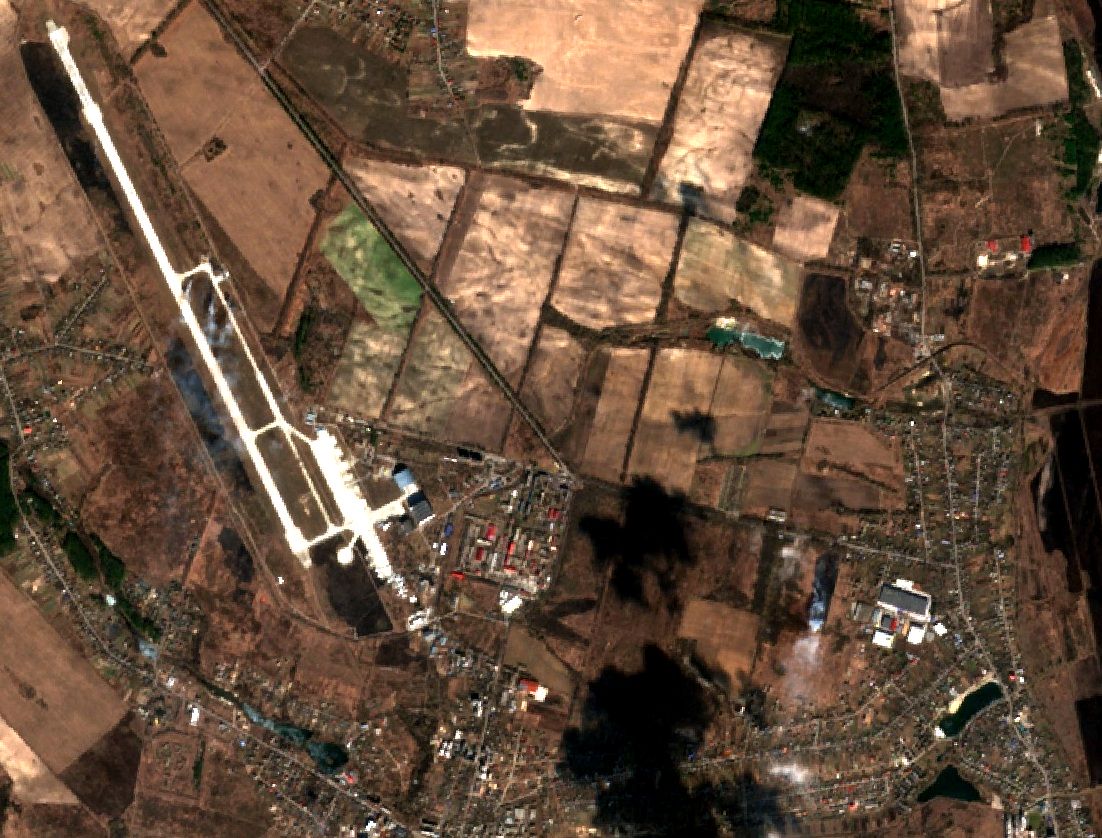
The second set of photos presents the area around the Chernihiv airport. The infrared images also show burning buildings in the city itself (lower left). Chernihiv was attacked on the first day of the invasion. The Ukrainian defenders repelled the assault preventing the enemy from capturing the city, thus prompting the invading army to bypass it and advance towards Kyiv. Over the weekend, the city remained under siege leading to the destruction of many of its buildings.
Copernicus is the European Union’s Earth observation program, looking at our planet and its environment to benefit all European citizens. It offers information services that draw from satellite Earth Observation and in-situ (non-space) data. The European Commission manages the program. Global data from satellites and ground-based, airborne, and seaborne measurement systems provide information to help service providers, public authorities, and other international organizations improve European citizens’ quality of life and beyond. The information services provided are free and openly accessible to users.*
 Subscribe to receive latest news: