Creotech Instruments, a leading Polish manufacturer and supplier of space technologies to the global market, carried out a project involving the implementation of one of the five repositories of the EU satellite data collection platform under the Copernicus program. This May, the company and its business partner, Hexagon, conducted new satellite observations over the territory of Ukraine. The data collected was used for agricultural analyses and allowed experts to estimate the current state of crops and vegetation indices in Ukraine. The results indicate that there is now much less vegetation in the analyzed areas relative to previous years. Undoubtedly, the ongoing hostilities have had a negative impact on crops and thus Ukraine’s food market. However, parallel analyses show that this year is also seeing a delayed growing season.
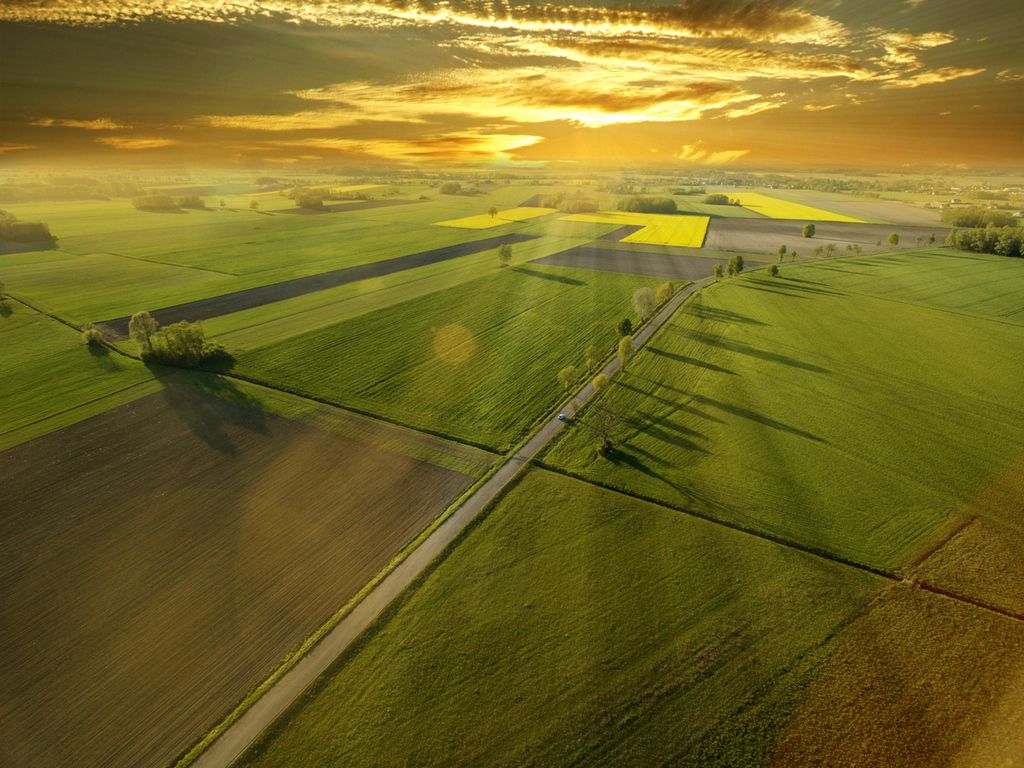
The growing season is the period during which plants go goes through their full development cycle and includes phases such as flowering and fruiting. Therefore, comprehensive protection is paramount at this time as it keeps plants in good condition and allows them to cope with the many challenges nature throws at them, including atmospheric changes. That is why Creotech Instruments analysts have also analyzed the influence of weather factors on the variability of the growing season in Poland.
“Our country has been struggling with a soil water deficit for years. We analyzed several areas at a latitude similar to Ukraine’s over the same intervals to establish the impact of weather factors on Poland’s arable lands. The results for this year clearly confirm the increasing delay in plant growing seasons in Poland,” – said Krzysztof Mysłakowski, Business Development Manager at Creotech Instruments.

Pic.: Average NDVI over the years for the area of Poland
The condition of crops is negatively affected by climatic factors, which translate, among others, into the existing droughts. The vast majority of Europe has been strongly influenced by this phenomenon in recent years, which has a substantial impact on the above-mentioned crops as well, with the ongoing military operations in Ukraine also taking their negative toll.
To analyze the current condition of crops in Ukraine, Creotech Instruments S.A.’s analysts and their partners from Hexagon employed a method involving the use of satellite images from the EU Copernicus program, i.e. optical images obtained through the Sentinel 2 satellite. The methodology underlying such analyses is based on the Normalized Difference Vegetation Index (NDVI), consisting in the processing of images from selected spectral channels. The index enables the overall condition of vegetation in a given area to be determined accurately.
Experts selected 395 areas in the south-eastern part of Ukraine to analyze the impact of hostilities on the condition of crops. These areas have the highest percentage of arable land with crops such as wheat, barley, sunflower and vegetables. The results indicate that the analyzed areas are now seeing much less vegetation than in the previous years.
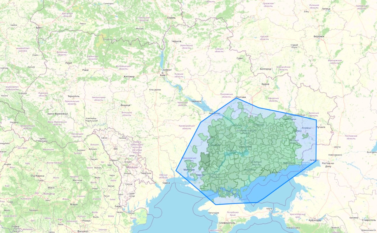
Pic.: Analyzed area of the crop condition in Ukraine
It should be noted that the experts examined the average vegetation index in the same areas in 2020, 2021 and in late March/early April and late April/early May 2022. The index is approx. 30% lower than in the previous years.
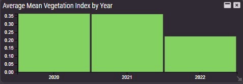
Pic.: Average NDVI in recent years for the entire study area in Ukraine
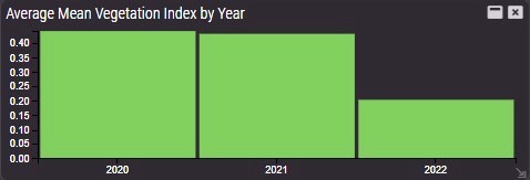
Pic.: Average NDVI in recent years for Ivanivska area, Chernihiv region
In total, over 1,400 analyses were performed using specialized software, Erdas IMAGINE for data processing and M.App Enterprise to present the results provided by Hexagon, who supported Creotech Instruments in analyzing and interpreting the results.
“The satellite data indicate that in the analyzed areas of Ukraine there is now much less vegetation than in previous years, undoubtedly chiefly on account of military operations. Keep in mind that Ukraine is one of the world’s largest exporters of food,” says Krzysztof Mysłakowski from Creotech Instruments. “However, considering that delayed growing seasons in many geographies, including in Poland, we still have to wait before making final conclusions about the actual impact of the war on the level of crops,” he adds.
Creotech Instruments had already carried out satellite analyzes over the territory of Ukraine before. In late February 2022, after the outbreak of the war in Ukraine, the company published satellite photos showing the effects of attacks mounted by Russian troops on two Ukrainian airports. The detailed photos provided a broad overview of the situation, facilitated fact-checking of information appearing in the public domain and offered substantial support in the way of battlefield analytics. For Creotech Instruments, the military sector will be one of the key potential recipients of satellite data that the company wants to provide after 2024/25, including imagery sourced from its own microsatellites.
 Subscribe to receive latest news: